Autumn Gear Guide
Find inspiration in our Gear Guide that will keep you out on your bike through wind or rain.
Download Now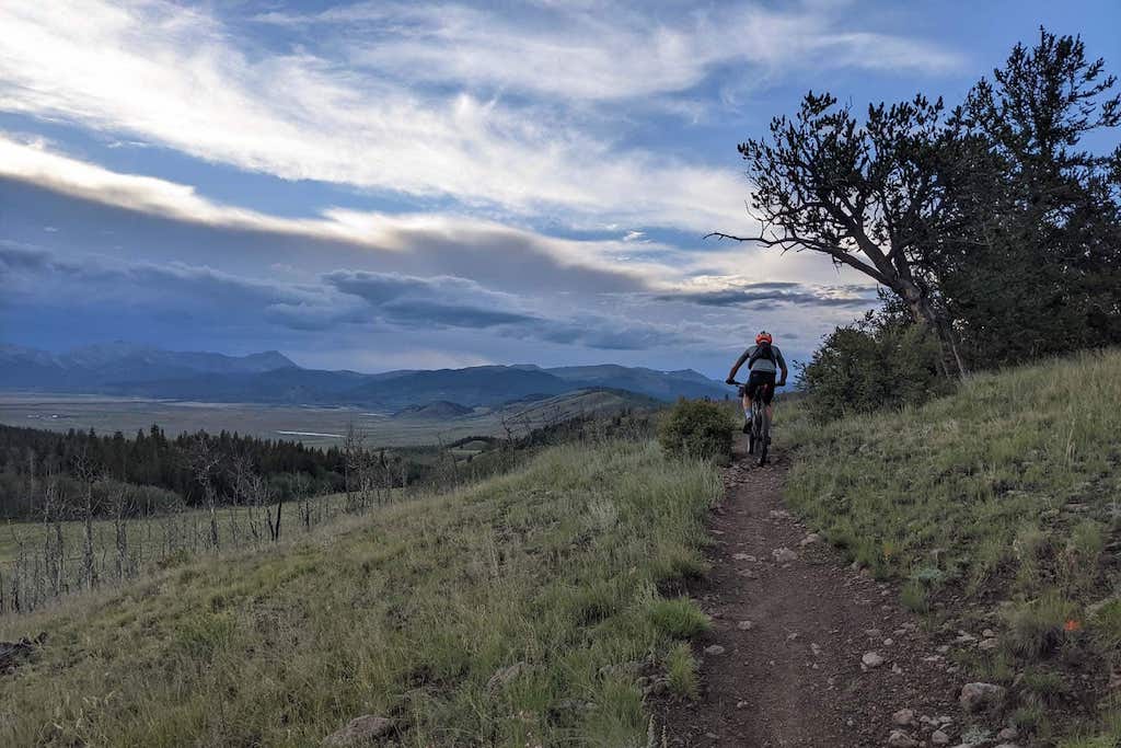
Bikepacking is an amazing fusion of bicycle touring and minimalist camping, which has gained immense popularity in North America. The continent offers diverse landscapes, from rugged mountains and dense forests to expansive deserts and scenic coastlines. For those seeking epic adventures, here are eight of our favourite bikepacking routes, each offering a unique challenge and […]
Bikepacking is an amazing fusion of bicycle touring and minimalist camping, which has gained immense popularity in North America. The continent offers diverse landscapes, from rugged mountains and dense forests to expansive deserts and scenic coastlines. For those seeking epic adventures, here are eight of our favourite bikepacking routes, each offering a unique challenge and an unforgettable experience.
Cycling on the Great Divide bicycle route
The Great Divide Mountain Bike Route (GDMBR) is the quintessential North American bikepacking adventure, spanning more than 3,000 miles from Jasper, Alberta, Canada, to Antelope Wells, New Mexico, USA. This route follows the Continental Divide, crossing the Rocky Mountains multiple times and offering some of the most stunning and remote scenery on the continent.
What Makes It Unique: The GDMBR is known for its challenging terrain, which includes long climbs, steep descents, and rugged dirt roads. It’s the world’s longest off-pavement cycling route, providing an unparalleled wilderness experience. Cyclists will navigate through pristine wilderness areas, high mountain passes, and small rural towns, often without seeing another soul for miles.
Best Stops Along the Way
Where to Camp
Colorado Trail (photo: Facebook Colorado Trail Association)
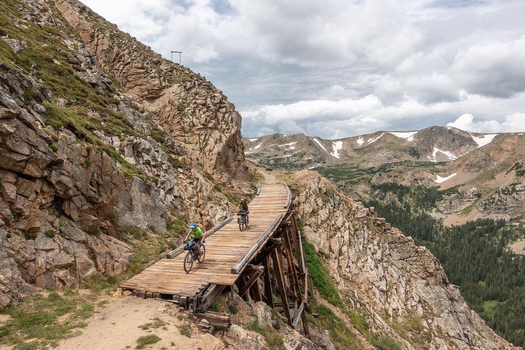
For those seeking high-altitude adventure, the Colorado Trail offers 567 miles of challenging and scenic bikepacking. Starting in Denver and ending in Durango, this route traverses the Rocky Mountains, reaching elevations of more than 13,000 feet (3,962 meters).
What Makes It Unique: The trail consists mainly of singletrack, with sections of rugged terrain, steep climbs, and technical descents. Cyclists will ride through alpine meadows, dense forests, and along pristine mountain lakes. Due to its high elevation, the trail is best ridden in the summer months, and cyclists should be prepared for rapidly changing weather conditions.
Best Stops Along the Way:
Where to Camp:
Overview:
The Pacific Coast Route stretches approximately 2,000 miles from Vancouver, British Columbia, Canada, to San Diego, California, USA. This route offers breathtaking views of the Pacific Ocean, rugged coastlines, and charming seaside towns.
What Makes It Unique:
Cyclists will primarily ride on paved roads and designated bike paths, with occasional detours through urban areas and coastal highways. The terrain includes rolling hills and coastal cliffs, with some challenging climbs and descents. The route is well-supported with numerous resupply points, campgrounds, and accommodations along the way.
Best Stops Along the Way:
Where to Camp:
The Oregon Outback Bikepacking Route is a challenging and remote adventure through Oregon, spanning 364 miles from Klamath Falls near the California border to the confluence of the Deschutes and Columbia Rivers. The route, known for its beauty and isolation, traverses mostly unsurfaced roads, offering cyclists a journey through desolate landscapes populated by wildlife such as coyotes and rattlesnakes. With an ascent totaling 14,376 feet and a high point of 5,224 feet, the route is recommended for experienced bikepackers who are prepared for limited water and services, and it takes approximately 5 to 7 days to complete.
Along the way, riders will encounter significant highlights such as the OC&E Woods Line State Trail, a 109-mile rail-to-trail conversion, and landmarks like Fort Rock and the Crooked River. The journey offers spectacular views of the Ochoco Mountains and culminates at the scenic Deschutes and Columbia Rivers. Cyclists can also enjoy unique stops like the Cowboy Dinner Tree, known for its 30-ounce steaks. The Oregon Outback is celebrated for its raw beauty and the sense of solitude it provides, making it a bucket-list route for dedicated bikepackers.
What Makes It Unique:
The terrain is varied, with sections of rough gravel, sandy tracks, and smooth dirt roads. Cyclists will encounter high desert landscapes, rolling hills, and expansive sagebrush plains. The route requires self-sufficiency, with limited resupply points, and is best ridden in the spring or fall to avoid extreme summer temperatures.
Best Stops Along the Way:
Where to Camp:
The Arizona Trail is an 800-mile (1,287-kilometer) route that spans the length of Arizona, from the border with Mexico to the Utah state line. This trail offers a diverse range of landscapes, including deserts, forests, and canyons, with challenging and technical terrain.
What Makes It Unique: Cyclists will navigate a mix of singletrack, dirt roads, and rocky paths, with significant elevation changes and technical sections. The trail passes through iconic locations such as the Grand Canyon, the Mogollon Rim, and the Sonoran Desert, offering unparalleled views and a deep connection to Arizona’s natural beauty.
Best Stops Along the Way:
Where to Camp:
The Baja Divide is an extensive off-road bikepacking route spanning from San Diego, California, to San José del Cabo, Baja California Sur. Created by Nicholas Carman and Lael Wilcox, this 1,751-mile trail connects the Pacific Ocean to the Sea of Cortez, traversing diverse landscapes that include historic Spanish mission sites, remote ranches, fishing villages, and bustling towns. Cyclists experience a range of terrains, from beautiful backcountry desert tracks to every major mountain range in Baja California. The region’s geography varies from beaches to forests and deserts, with notable landmarks like Picacho del Diablo, the highest peak at 3,096 meters (10,157 feet), located in the Sierra de San Pedro Mártir.
What Makes It Unique: The terrain includes sandy tracks, rough gravel roads, and rocky paths, with significant climbs and descents. Cyclists should be prepared for challenging conditions, including limited water sources and resupply points. The route is best ridden in the winter months to avoid extreme summer heat.
Best Stops Along the Way:
Where to Camp:
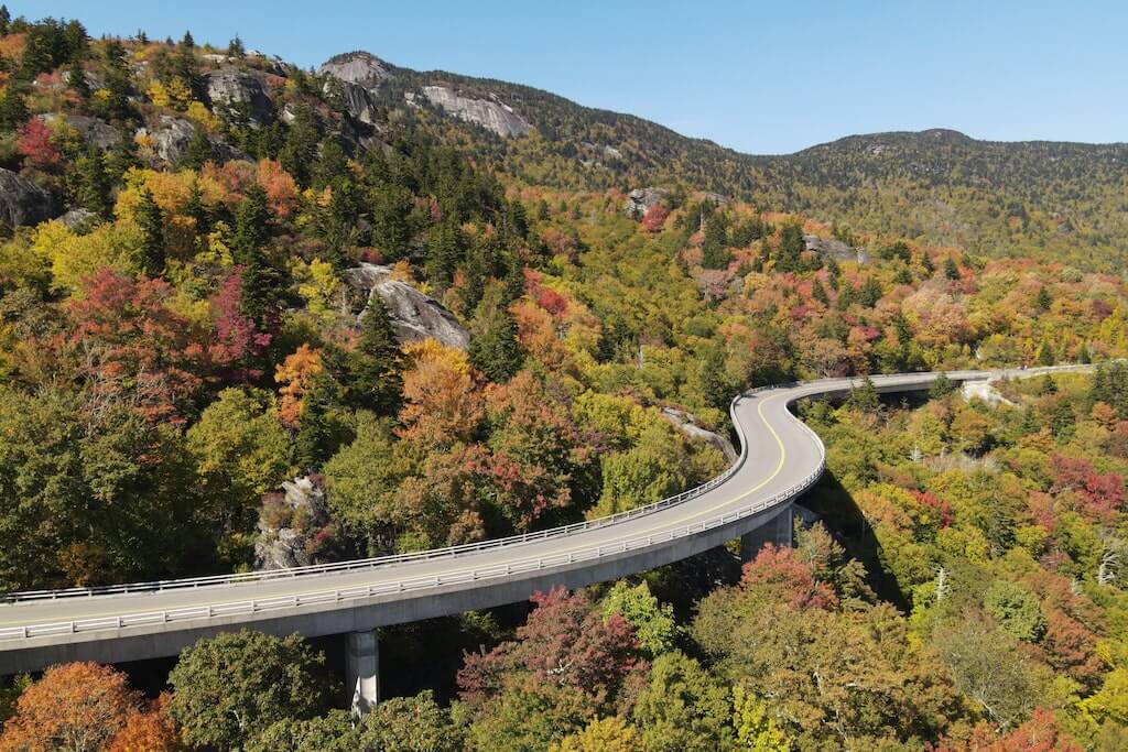
The Blue Ridge Parkway offers a scenic and challenging bikepacking route through the Appalachian Mountains. Spanning 469 miles (755 kilometers) from Afton, Virginia, to Cherokee, North Carolina, this route is known for its beautiful mountain vistas, dense forests, and vibrant fall foliage.
What Makes It Unique:
Cyclists will primarily ride on paved roads with gentle curves and rolling hills. The terrain includes long climbs and descents, with numerous overlooks and points of interest along the way. The route is well-supported with campgrounds, accommodations, and resupply points, making it accessible for cyclists of all levels.
Best Stops Along the Way:
Where to Camp:
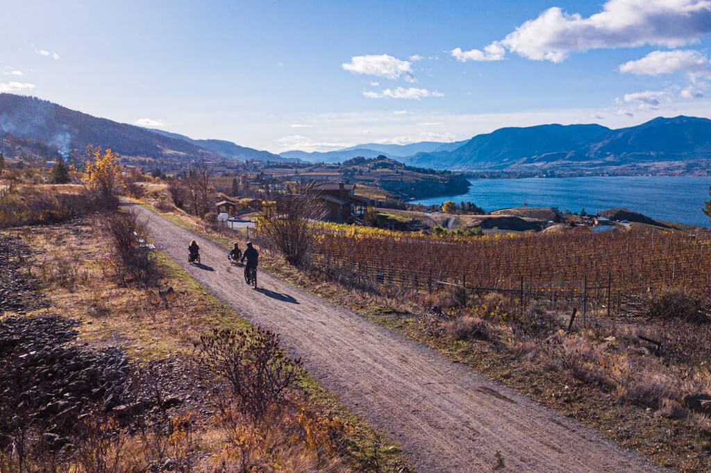
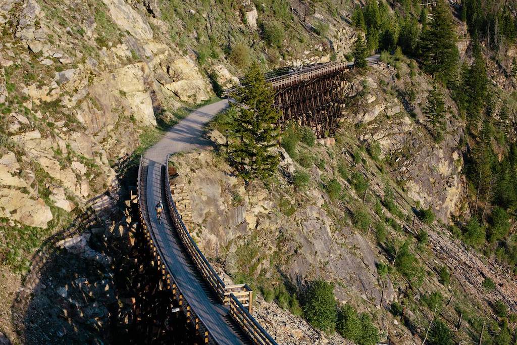
Adaptive trail riding along the Kettle Valley Rail Trail in Penticton (Travel Penticton/Nathan Penner)
The Kettle Valley Rail Trail, spanning 492 kilometers, offers an impressive and scenic journey through British Columbia from Midway to Hope. This trail, following a historic railway line, passes through the Boundary region and up through the Okanagan, showcasing a variety of BC’s unique terrains. Cyclists can explore historic mining towns, both abandoned and active, along the route, envisioning the era when trains carried people and mined goods through these areas. With the trip starting at Mile 0 in Midway, the trail serves as a midway point between the Rocky Mountains and the Pacific Ocean, making it a geographically significant and picturesque ride.
The trail’s varying conditions, from gravel and dirt to more rugged sections, cater to adventurous bikers. Hybrid and mountain bikes are recommended due to the mixed surface quality. Riders should be prepared for potential encounters with motorized vehicles and rougher trail segments, especially in more remote areas lacking amenities. Despite these challenges, the trail offers stunning natural beauty and historical intrigue, with several destinations along the way providing accommodation, food, and beverage options. The Kettle Valley Rail Trail is accessible for hiking and biking, ensuring an enriching and diverse experience for all trail users.
What Makes It Unique:
The trail is a blend of gravel paths, dirt tracks, and some paved sections, with gentle grades and smooth surfaces suitable for cyclists of varying skill levels. It passes through diverse landscapes including lush forests, expansive vineyards, and picturesque lakes, offering a glimpse into British Columbia’s rich history and natural beauty.
Best Stops Along the Way:
Where to Camp:
Find inspiration in our Gear Guide that will keep you out on your bike through wind or rain.
Download Now

Leave a comment